A four-step workflow built for real farms
Modern technology, delivered the way Indian farmers actually work — fast, simple, and on WhatsApp.
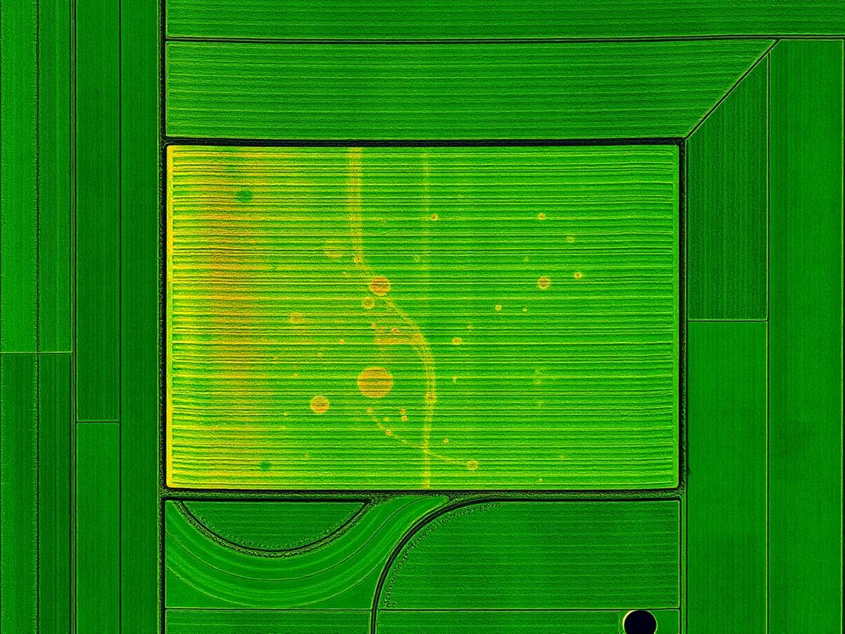
Scan
Our certified pilot flies a DJI Mavic 3 Multispectral drone over your farm at optimal altitude. The drone captures high-resolution RGB plus multispectral bands (Green, Red, Red Edge, Near-Infrared) of every square meter of your land. A typical 5-acre scan takes under 25 minutes.
Analyze
Imagery is uploaded to our cloud where AI models compute NDVI (Normalized Difference Vegetation Index) and NDRE (Red Edge) maps. These reveal photosynthetic activity, chlorophyll content, and water stress invisible to the human eye.
Diagnose
Custom-trained deep learning models classify problem zones: fungal disease, nutrient deficiency, water stress, pest activity, or healthy growth. Every flag comes with a confidence score and severity grade so you can prioritize.
Recommend
Our agronomy engine matches each diagnosis with an organic-first remedy: neem oil spray, Jeevamruth, Panchagavya, micronutrient sprays, or rotation advice. You get a WhatsApp-friendly PDF with zone maps and an action plan.